Acropole des Draveurs Trail
| Where: | Hautes-Gorges-de-la-Rivière-Malbaie National Park, Quebec, Canada |
|---|---|
| When we hiked: | July 2018, September 2020 |
| Difficulty: | Hard |
| Length: | 10.5 km |
| Elevation gain: | 875 м |
| Route type: | Out & back |
| Address: | Acropole des Draveurs Trail |
| More pictures: | Acropole des Draveurs Trail Photo Gallery |
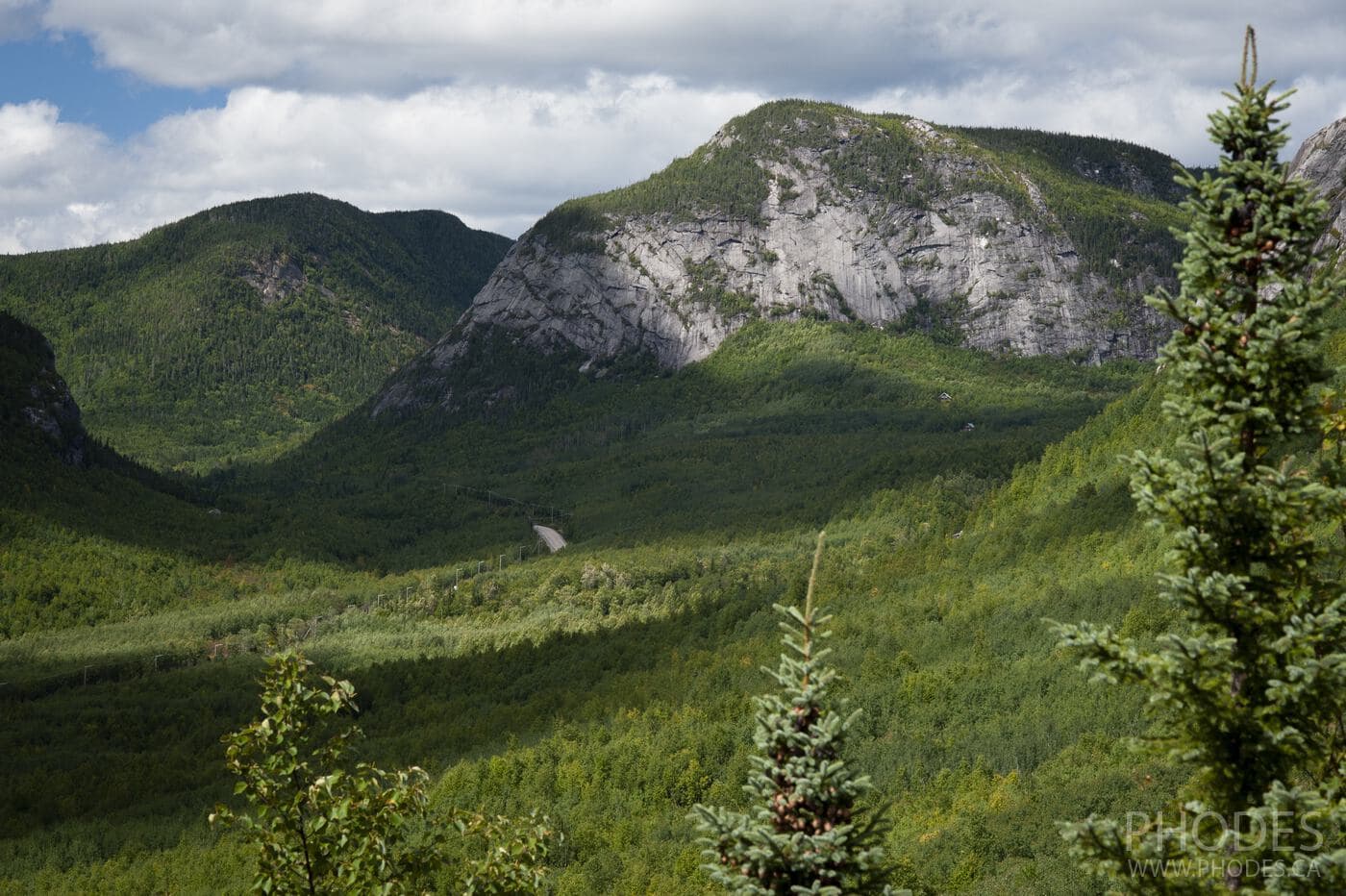
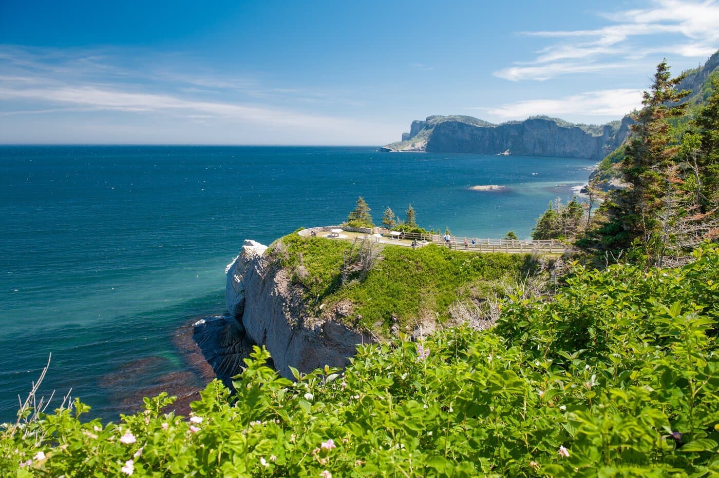
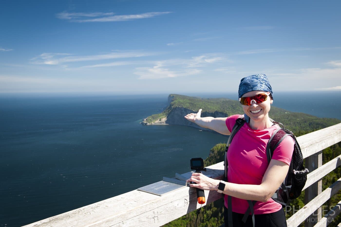
The Acropole des Draveurs trail at the time of writing this post (August 2023) is the only trail we have hiked twice. The first time was in July 2018, the second in early September 2020. What attracted us to this trail that we climbed there for the second time? Firstly, the first time we were limited in time and couldn't fully enjoy the views. Secondly, for the same reason we didn't make it to the third peak. Thirdly, all the photos were taken in a hurry and there were very few of them. All photos in this post are from our second hiking in September.
If you ask us what impressed us the most about this hike, we will answer:
- the first 2 kilometers of the trail
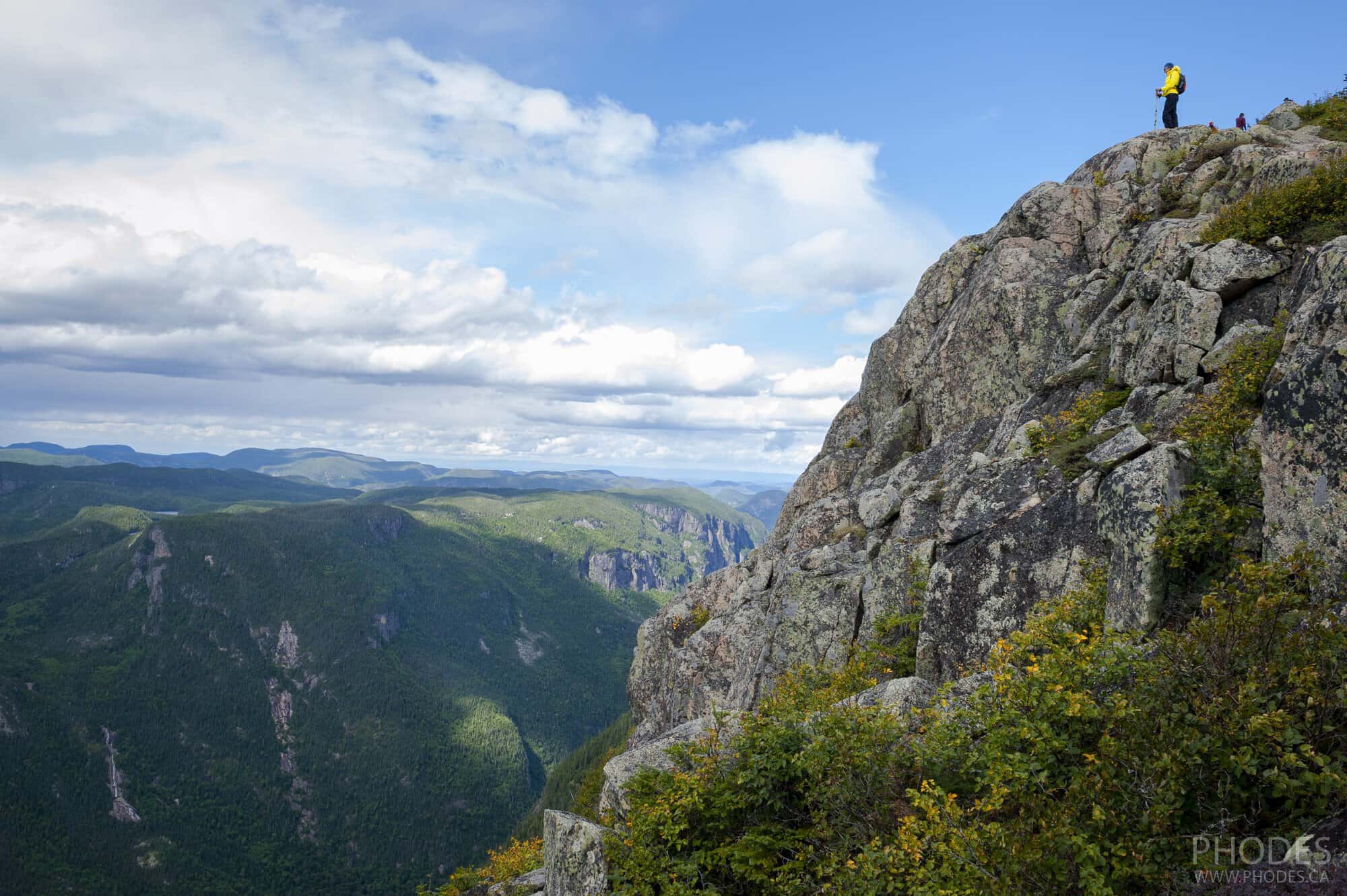
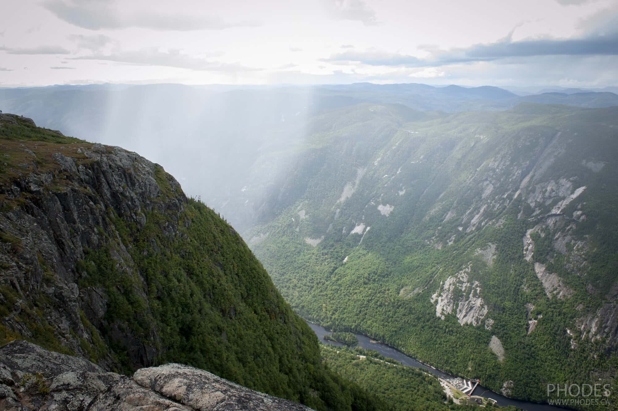
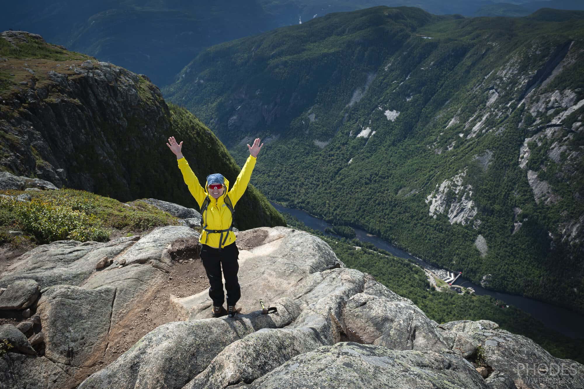
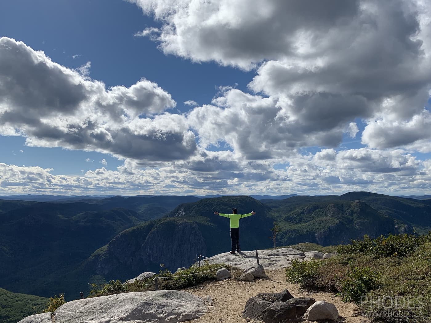
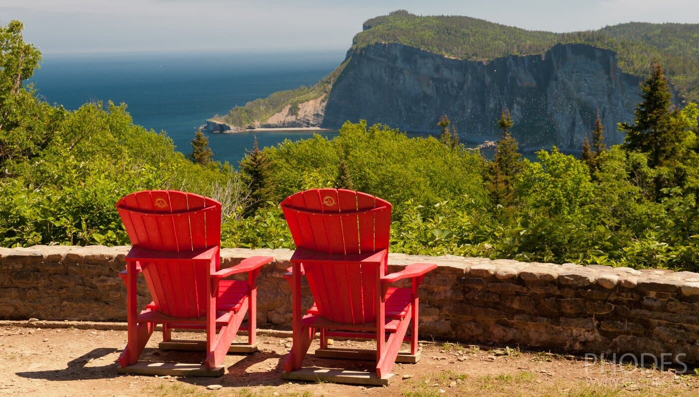
- the view into the abyss and the 360 panorama at the top
- fast-changing weather at the top of the trail
At the time we climbed the Acropole des Draveurs trail, it was the most difficult one we had ever been on. The steep climb at the beginning made us stop at times because we didn't have enough oxygen. And those stone steps... At some point you think they will never end!
Travel tip
For those who are going to the Acropole des Draveurs trail for the first time and are not very prepared, hold out for the first two kilometers!
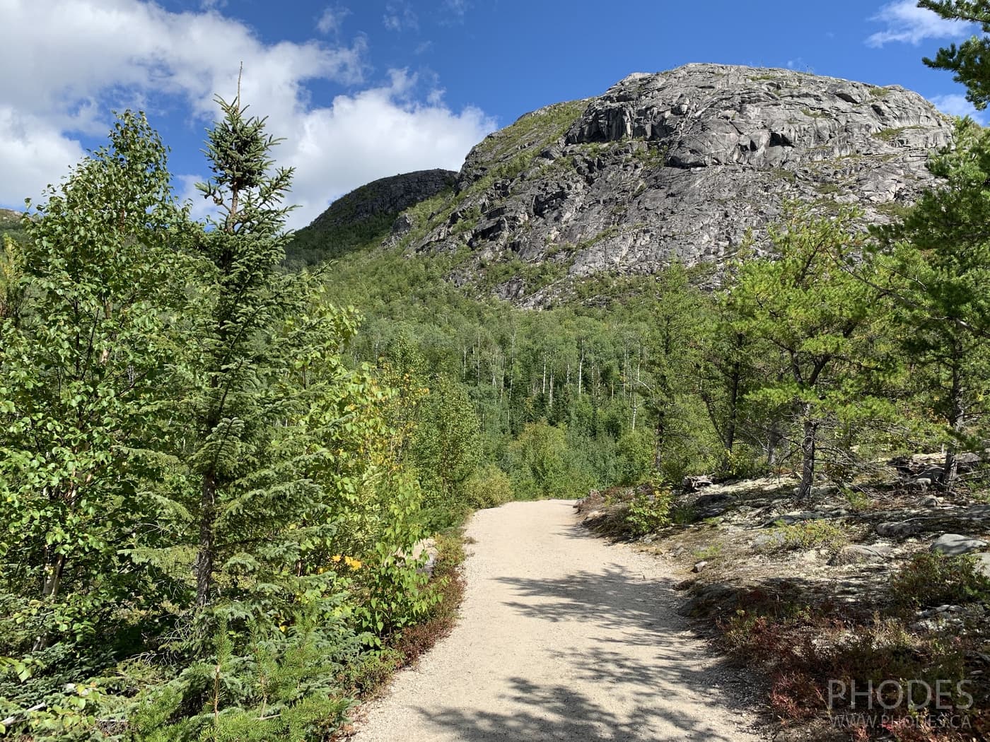
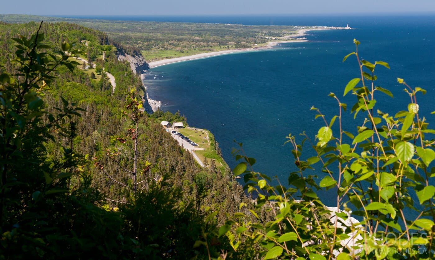
The whole trail goes through the forest - so even in the July heat it was bearable. There is only one point where you can get out of the forest and see how much you have climbed. But this point is at the beginning of the trail. Then you just wind kilometers through the forest.
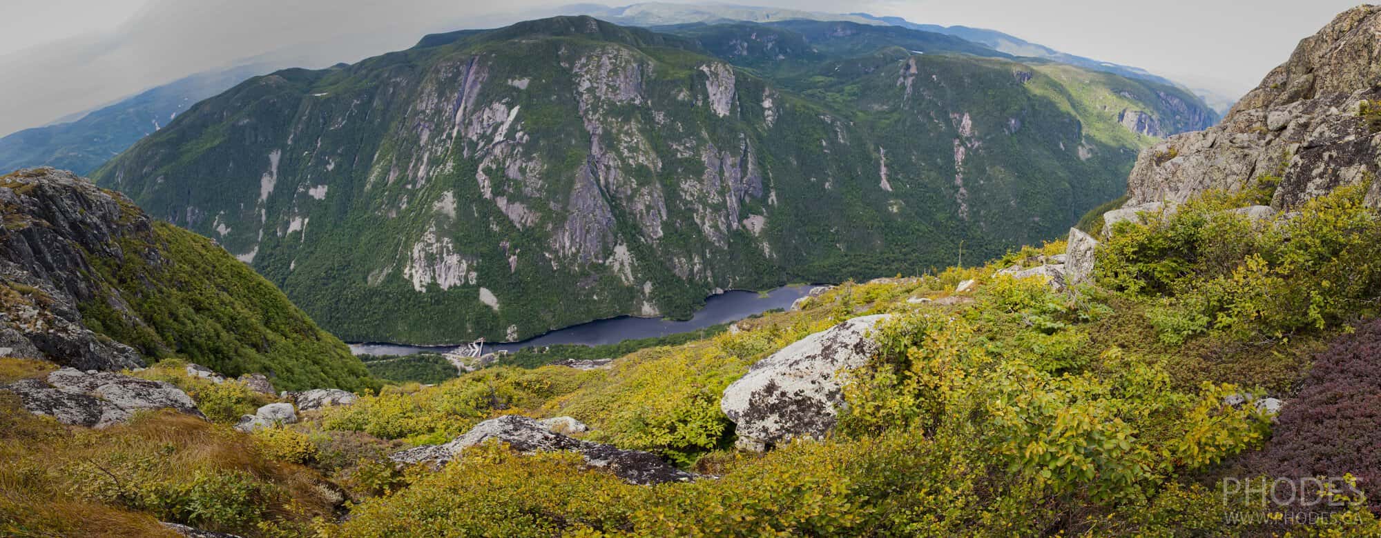
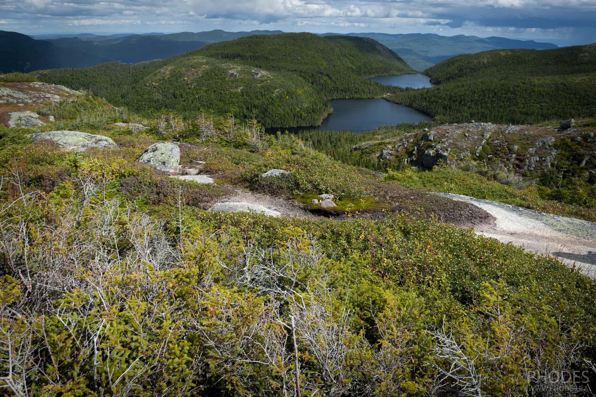
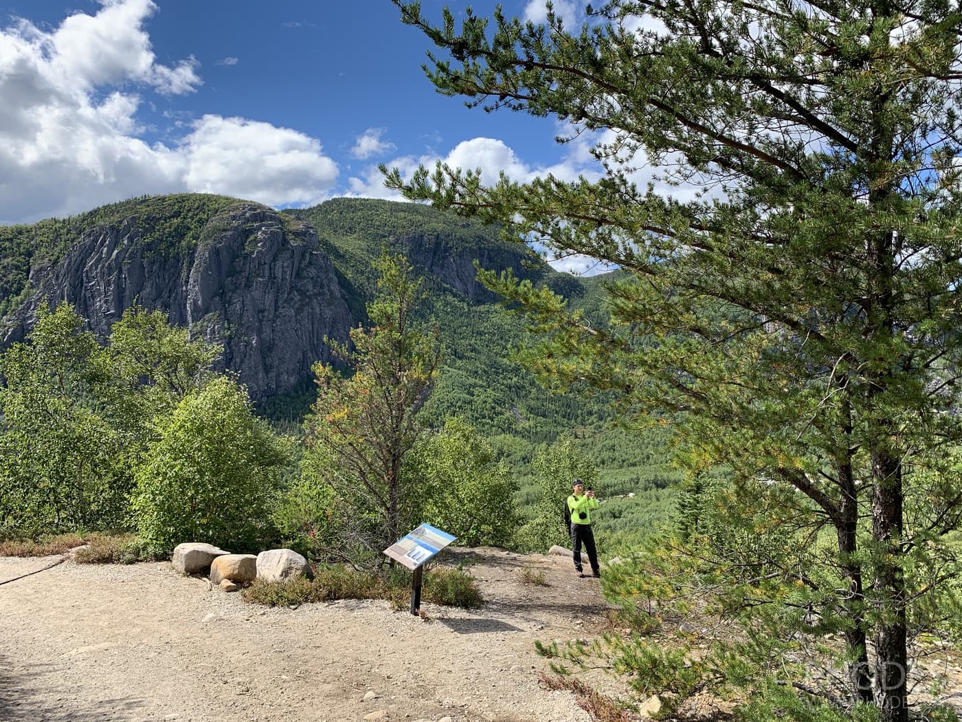
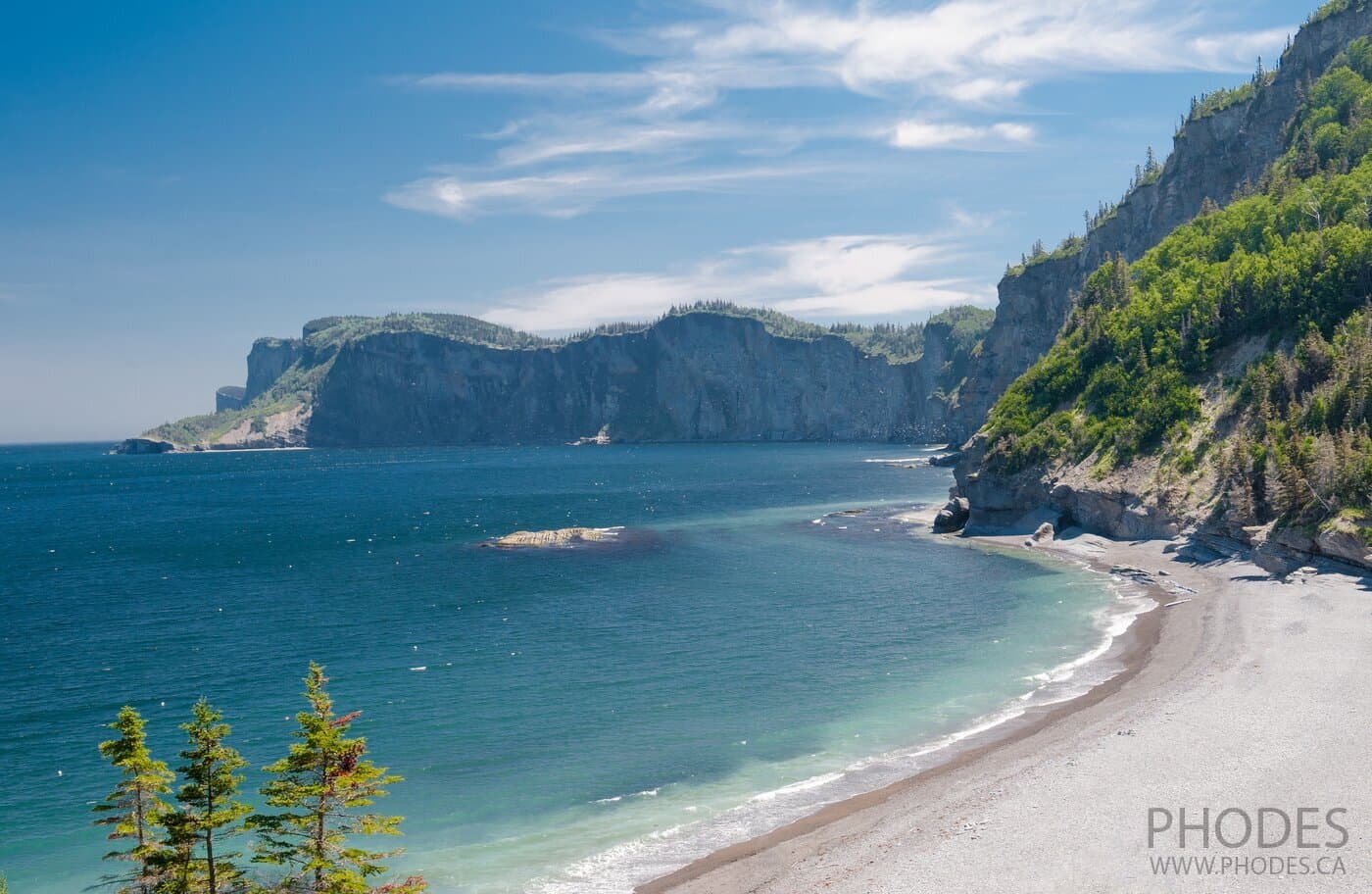
On our first hike to Acropole des Draveurs, there was a moment of disappointment when we came out of the forest and saw a small area with a bunch of people. We thought: we had come all this way just to be crowded here and wait in line for a photo!!! Then we looked to the right - and there stretches the stone expanse! In our first hiking we reached only the first peak. And there are three of them.
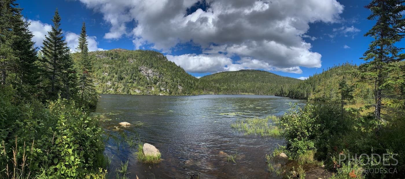
In our second hiking in Acropole des Draveurs, we climbed all three. From the third peak we saw the lakes! It seems a bit strange that there are lakes at such an altitude (1,000 meters) above sea level. Then you remember that the Charlevoix region owes its beauty to a meteorite that fell in this area 350 million years ago. 🙂 The craters became the lakes.
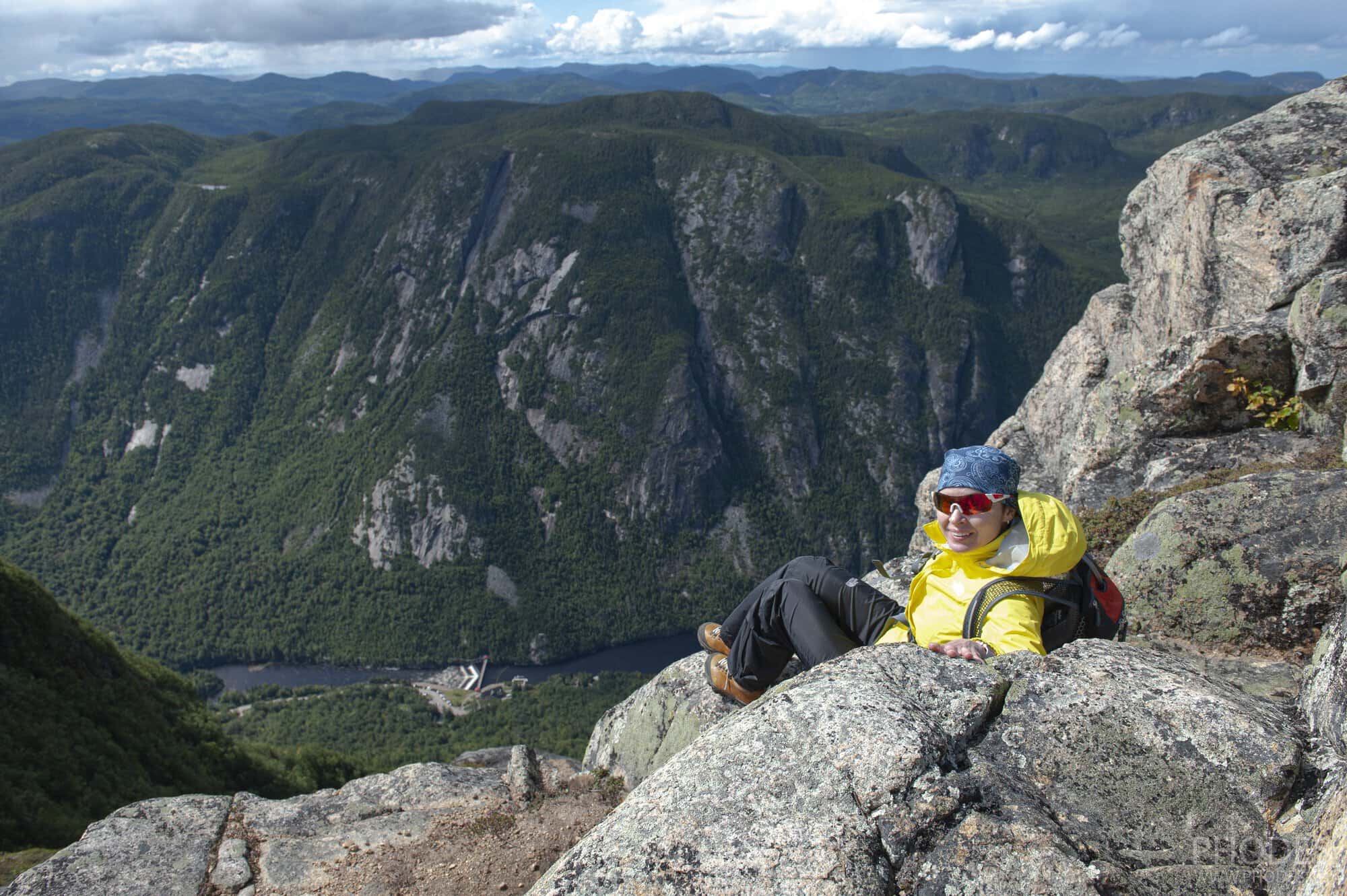
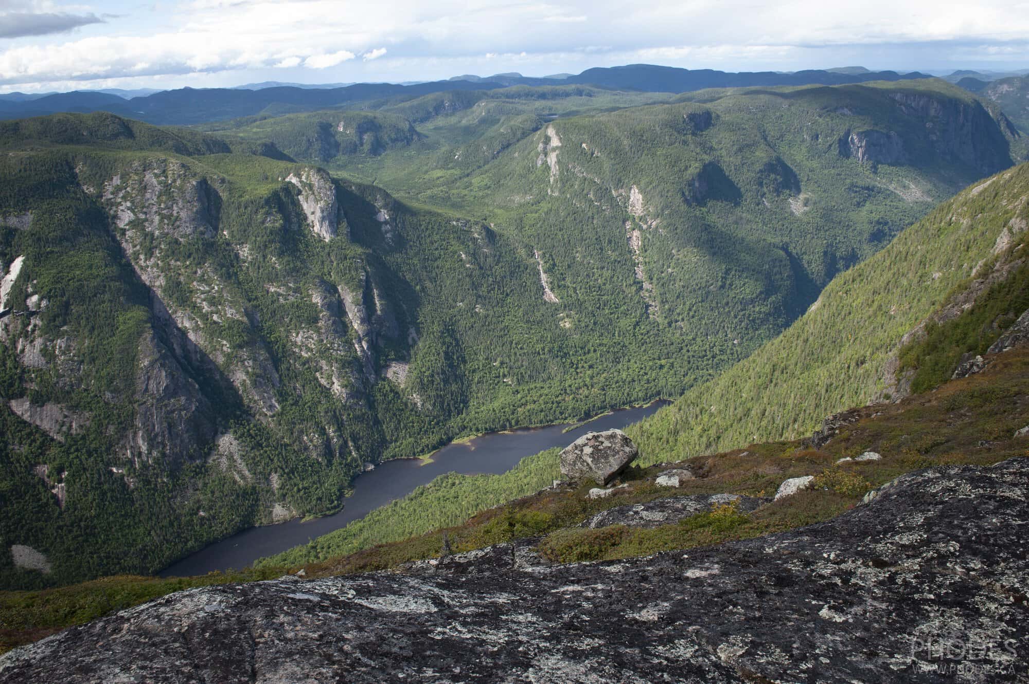
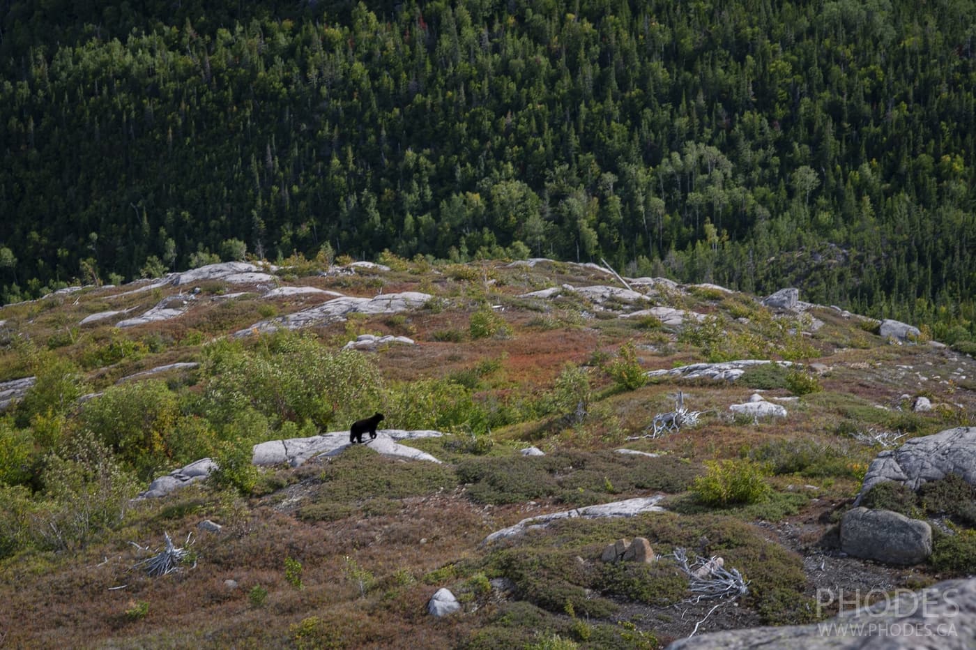
The views into the abyss from the top are a separate topic. It is difficult to convey it on photos. But your knees shake if you get close to it. There are no barriers against falling into the abyss. Only along the trail are stretched ropes so that people do not disturb the integrity of nature. At summit number 3, these guardrails are also for safety purposes. We saw bears in the distance.
Travel tip
Bring windbreaker jackets with you and depending on the season, warm clothes as well. At the top especially with a strong wind, the temperature drops a lot. In September at the summit we got wet and dry twice!
Both times we went to the Acropole des Draveurs trail on a weekend. Since the parking lot next to the trail is not very big, a shuttle took us from the Félix-Antoine-Savard service center to the beginning of the trail. Accordingly, when you finish the trail, you have to wait for the bus to get you back to the parking lot.
While waiting for the shuttle, we noticed a family with two boys, the youngest was at most about 5 years old. We looked at the puny dad in bewilderment. No way, the dad was carrying the boy all the way to the top. Being in complete amazement, we decided to ask about it. No, the parents said, the boy climbed on his own. Dad only helped him in places where the son couldn't reach to put his foot. To say we were astonished is to say nothing. After that we are not going to discourage to go hiking to hard trails with children. Children, like parents, may be different!
Lac-des-Cygnes Mount
| Where: | Grands-Jardins National Park, Quebec, Canada |
|---|---|
| When we hiked: | September 2020 |
| Difficulty: | Moderate |
| Length: | 9.2 km |
| Elevation gain: | 439 м |
| Route type: | Out & back |
| Address: | Lac-des-Cygnes Mount (Visitors Center) |
| More pictures: | Lac-des-Cygnes Mount Trail Photo Gallery |
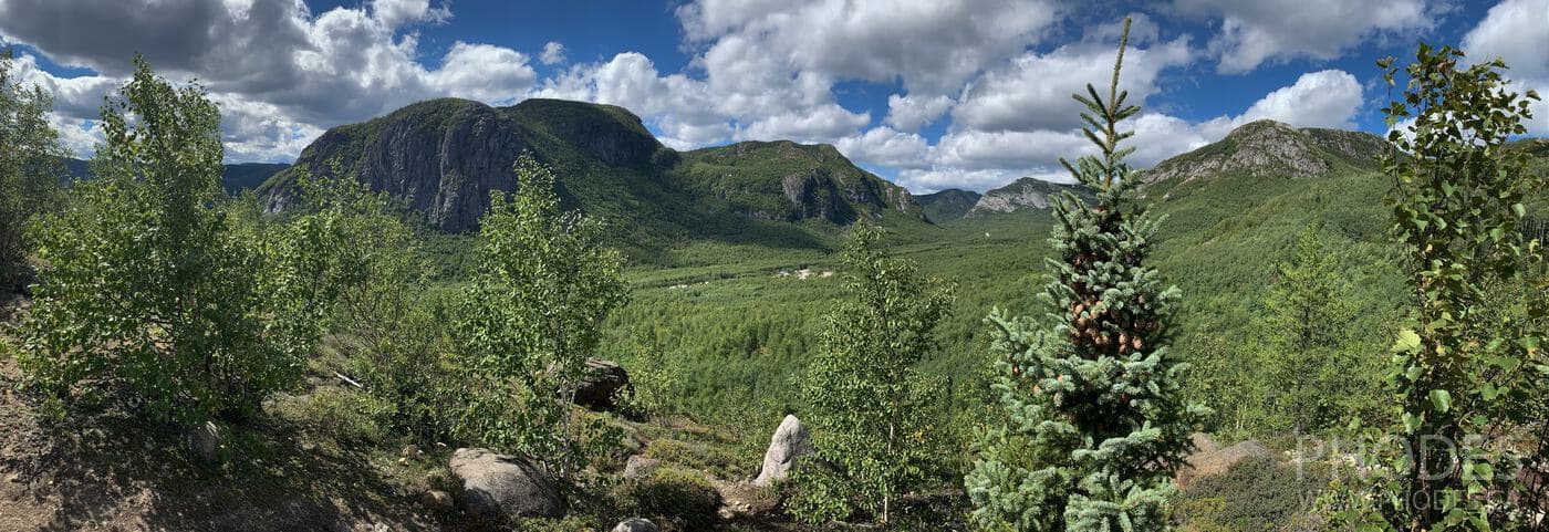
The impressions of each hiking trail we go on depend on where we've been before. In Lac-des-Cygnes Mount trail we went in September, a year and a half after we had been to Acropole des Draveurs. To understand, both Hautes-Gorges-de-la-Rivière-Malbaie National Park with Acropole des Draveurs Trail and Grands-Jardins National Park with Lac-des-Cygnes Mount trail are located in Quebec's scenic Charlevoix region.
Travel tip
If you've never been to Сharlevoix region in province of Quebec, we highly recommend you do so at your earliest opportunity. 🙂
Charlevoix is our favorite region of Quebec. At least once a year we go there to “recharge” our batteries.
So, if you want to get a bird's eye view of Charlevoix, but the idea of going up the hard Acropole des Draveurs trail scares you, the Lac-des-Cygnes Mount trail is a great alternative.
At first that trail may seem somewhere even boring especially for experienced hikers. For about three kilometers we followed a gravel and dusty trail under the September sun. What made it fun was that there are several points of views with information stands overlooking the picturesque hills of the park.
What surprised us was that there are two restrooms on the trail! It's not often we've seen that. The first one is after 3 kilometers. The second one is 100 meters away from the first one at Lake Georges. By the way, that lake is a nice place to stop and relax. There are a couple of picnic tables by the lake.
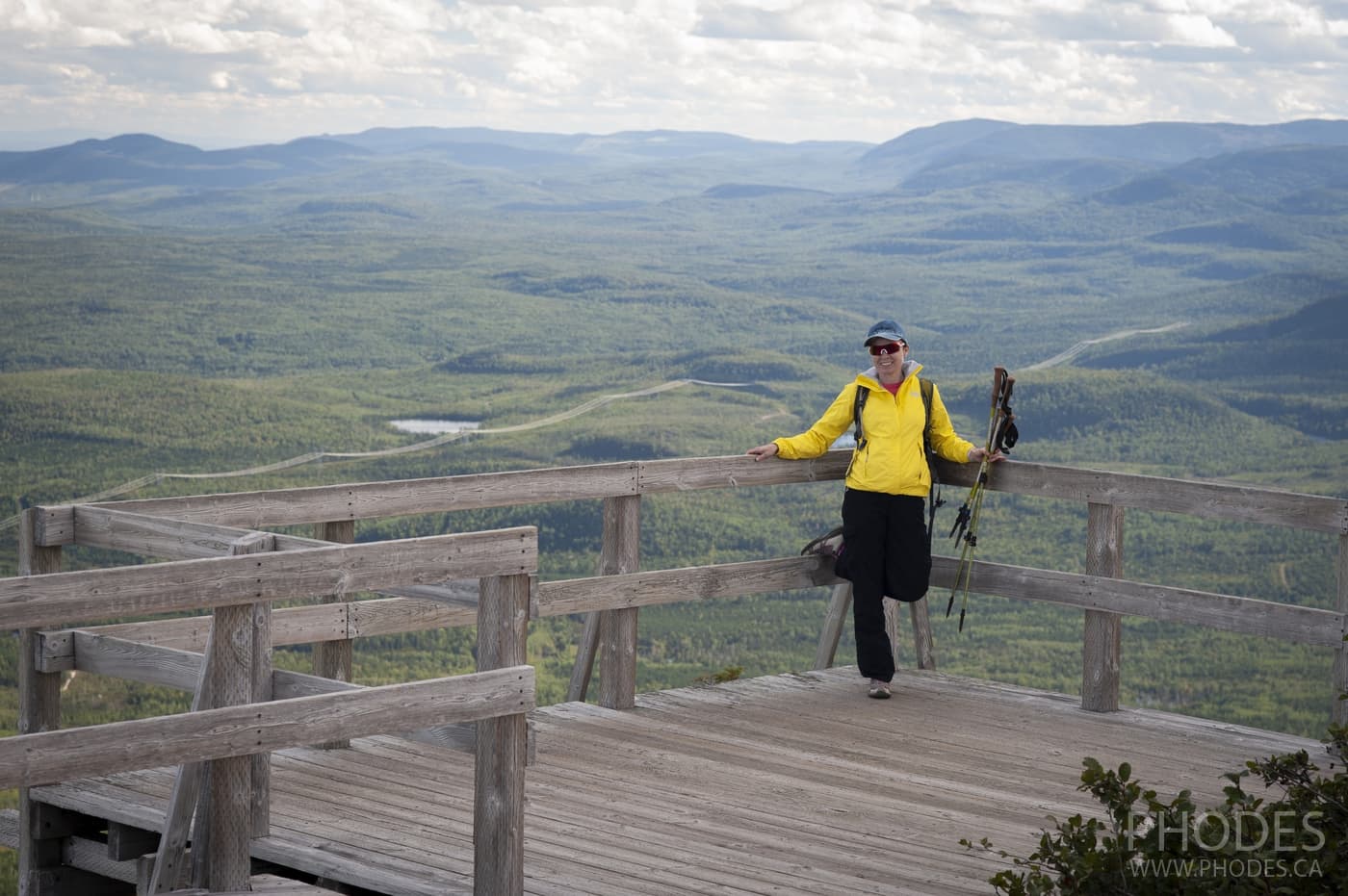
All our boredom was gone when we got to the top of the mountain. For some reason we thought there would be one small observation deck. We were wrong. On the mountain itself, there was an expanse of space waiting for us. A 360 panorama. You can have lunch with views to the different sides of the world! 🙂 Peaceful views! And bears...in the distance 😉
Summit Mount Alban
| Where: | Forillon National Park, Quebec, Canada |
|---|---|
| When we hiked: | July 2020 |
| Difficulty: | Moderate |
| Length: | 8.2 km |
| Elevation gain: | 455 м |
| Route type: | Loop |
| Address: | Summit Mount Alban Trail |
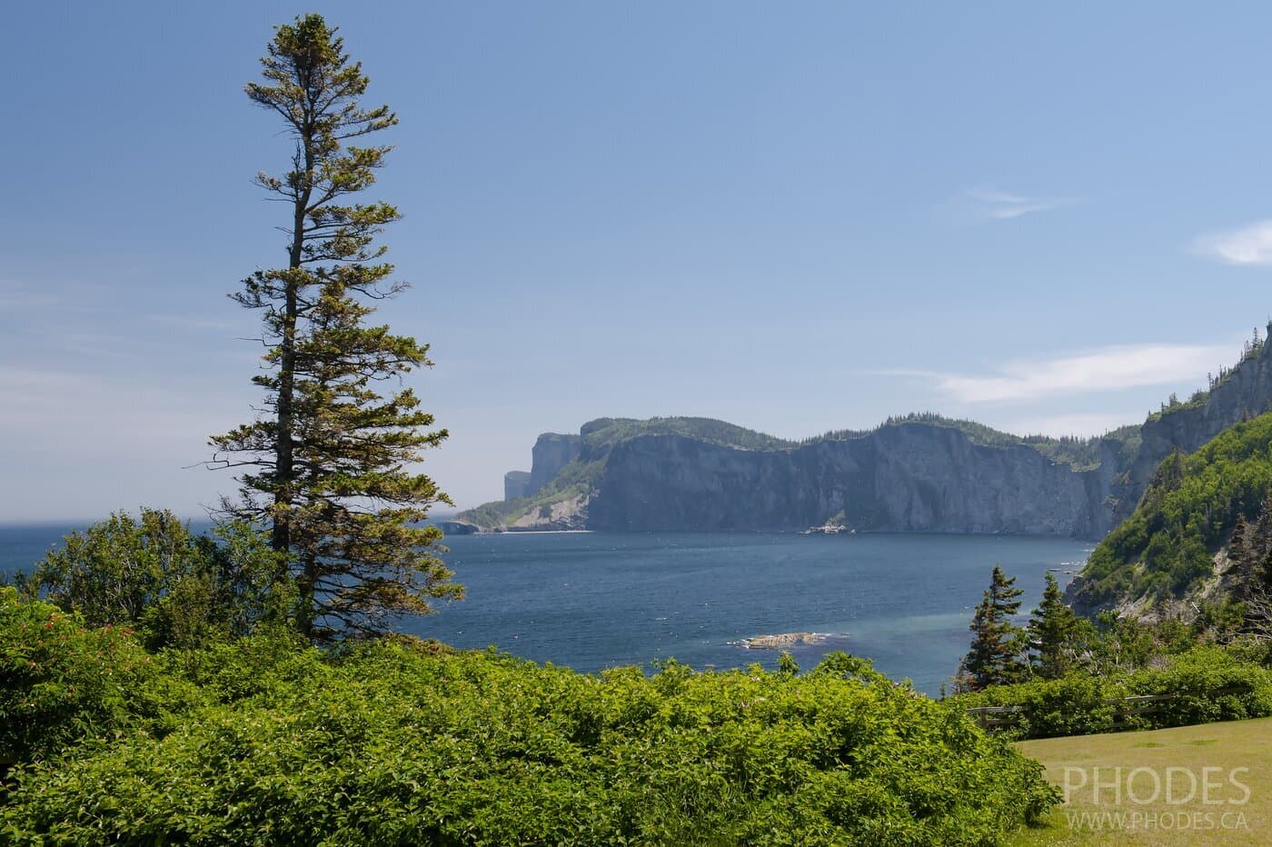
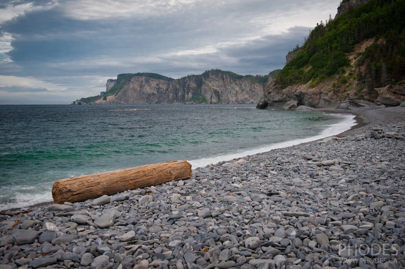
It will sound strange, but we were most impressed by the pebble beach of Cap Bon Ami, which has nothing to do with the Summit Mount Alban trail. But we have to admit that we got to know the beach through our hobby of going hiking. At the end of the day, we spent more time at Cap Bon Ami Beach than we did hiking. Although our visit to Forillon National Park was in mid-July and we weren't there on the coolest day, there were no swimmers in sight.
We tried going into the water - it was ice-cold. However, it's nice just to be on that beach: sit on the cobbles, listen to ocean sounds, breathe in the sea air and admire the turquoise water of the Gulf of St. Lawrence.
We went to the beach before the hiking, when it was still crowded and after, when there was no one left.
Travel tip
The weather on the Gaspé Peninsula is very changeable. Check the forecast before you go hiking. It may happen that you go up and everything around you will be covered by fog.
Flying drone over Gaspésie - Quebec - Canada - part 1
Flying drone over Gaspésie - Quebec - Canada - part 2
What about the Summit Mount Alban trail itself?
The most memorable thing about it is the observation tower that offers a panoramic view. It is said that in good weather and with binoculars, you can see Le Rocher Percé rock and the town of Gaspé. To reach this main point, you will need to walk up a slight climb. There are a couple of lookouts along the way from where you can admire the seascapes.
At two kilometers, the climb is about 300 meters. After you pass the observation tower, the trail can be considered an easy walk through the forest. There was nothing else of interest.
If you are limited on time, you can skip the full loop and do the shortened version of the Summit Mount Alban trail. Simply walk to the observation tower and return the same way back. It will take no more than two hours.
What makes our hiking easier?
What we realized when we first started hiking is that the most important thing is to have enough water. At some point you get tired of carrying bottles of water with you. Plus, you have to carry them back. Not heavy, but why? So we decided to end this problem once and for all by buying a combo:
- A backpack
and a hydration reservoir
- we don't go hiking without those two items.
The hydration reservoirs come in different volume capacities. Ours, for example, are for 2 and 3 liters.
They are quite enough for one-day hiking. You can buy a
hydration pack.
This is a two-in-one solution: you will get the backpack and the hydration reservoir all together.
Equally important for us in hiking are also: - Hiking poles - poles are especially useful for steep rocky descents. For easy hiking you don't need them. But in difficult hiking, they are simply irreplaceable. It is especially good if the poles are telescopic. You can always change the height. When climbing we shorten them, when descending we lengthen them. How many times it has happened to us when we just prayed on our hiking poles! Otherwise we'd come back with a sprained leg at best.
- Buffs to cover head or neck. We rarely go hiking without them. On the one hand, they protect from the sun and forest insects, on the other hand, they absorb sweat. We often use them in winter when we cross-country ski.
- Hiking boots (men's, women's). Hiking shoes are very important, especially when the trail is rocky or wet and muddy. Hiking boots usually have a reinforced toe to resist impacts.
- Power Bank - over time, we have added multiple gadgets that we take on our hiking trips. Each of them needs power. Although our power bank weighs a lot, it has enough capacity to recharge several devices.
Useful links
- https://www.alltrails.com/ - the most useful resource when we go hiking. We especially like the app. There you can find all the information you need about the hiking trail from the location to the latest hiker reviews.